Let’s work together to deliver safe and efficient solutions that will enhance community connectivity, create land use opportunities and keep downtown and the region connected.


Understand why WisDOT is undertaking this study now.

Stay informed about the Study’s progress and its current phase. Public involvement, stakeholder outreach and local government coordination will continue throughout the Study.

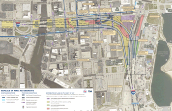
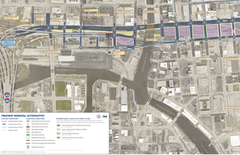
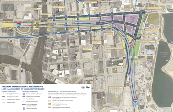
Check out how the interchange and local streets are being used today.